


Coastal and Border Surveillance
Integrated Systems for Monitoring Ports, Coastlines and Land Borders
TMP Systems Provide Safety and Security to the World’s Waterways and Marine Resources
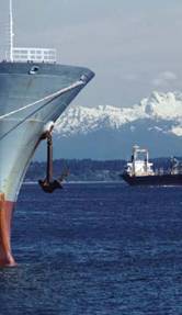
Every waterway presents unique safety and security challenges. Marine and atmospheric environments, local maritime laws and increasing vessel traffic all complicate the navigation of waterways, ports and rivers. Maritime borders must be protected from illegal immigration, drug traffic and environmental hazards. Fisheries and other natural resources are in danger of depletion. Cargo and passenger ships need to arrive safely and on schedule at their intended destination. Ships in distress need to be quickly found and assisted. Commercial and Naval ports need protection from terrorist attacks.
Tempestini Group, combining years of experience in advanced sensor technology and systems integration, is helping governments, waterway authorities and the mariner by providing reliable and cost-effective solutions to better manage vessel traffic, monitor ports and coastlines, protect assets and support search and rescue missions throughout the world.
Governments and port authorities around the world are turning to Tempestini Group for advanced technologies that meet the safety and navigational challenges of today’s maritime industry.
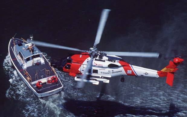
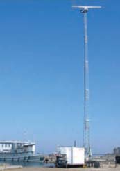
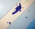
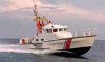
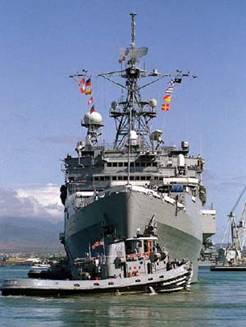
Remote radars integrated into the U.S. Coast Guard’s Ports and Waterways Safety System guide tankers laden with oil through the Prince William Sound in Alaska. The system will help prevent environmental disasters like the EXXON Valdez oil spill of 1989. |
|
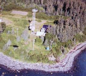
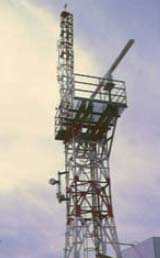
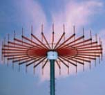
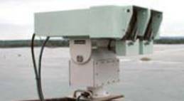
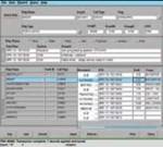
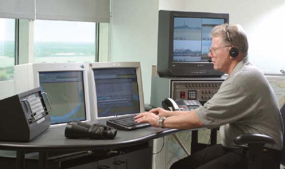
Sensor Suite
TMP-MTM300 Processing
- Multiple sensor correlation
- Target tracking
- Track and database integration
- Rule-based decision aids
- Vessel movement reports
- Track histories
- Ship ID and characteristics
|
|
|
|
|
|
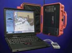
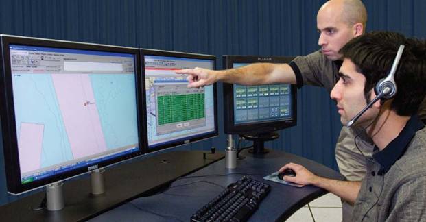
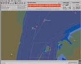
Command and Control
 Precision Radar and Tracking Display |
|
|
|
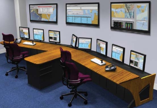
Communication with Response Assets
Applications for Maritime Information Management Technology
 Tempestini Group applies its core information management and integration technologies to the following maritime applications:
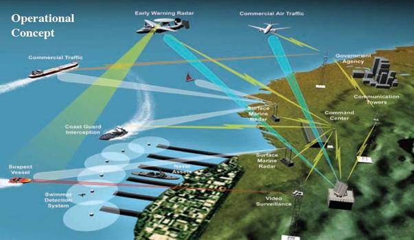
Coastal and Maritime Security and Surveillance — Multiple sensor integration, information processing, storage, display and dissemination provide critical decision-making support. Wide-area surveillance systems detect, classify and track threats and disseminate information to the proper response personnel. Communications systems enable cross-border information sharing and cooperation among coast guards, customs, port authorities and emergency response agencies.
Vessel Traffic Management — Vessel Traffic Management Information Systems (VTMIS), integrating sensors, AIS (Automatic Identification Systems), commercial hardware, expert rule-based software and communications links, manage vessel traffic, monitor the waterway environment and support port and harbor resources.
Commercial and Oil Port Management — VTMIS and resource management tools are configured for port operators and logistics planners. Special sensors and systems for oil and gas ports increase the safety of vessel transit and berthing.
Search and Rescue — Linking shore-based emergency communications and command infrastructure to rescue services saves lives and property at risk in the maritime environment.
World-Class TMP-MTM300 System
At the heart of the Maritime System is powerful rules-based software. Advanced processing integrates and displays vessel tracks from the sensor suite. Vessels tracked by multiple sources are correlated into a single unambiguous fused track providing a clear picture to the operator. Decision support software continuously monitors all vessel activity to automatically alert the operator of rules violations, risks or security intrusions in both real-time and in a predictive mode. To provide maximum information on any vessel to the operator immediately, systems include an integrated database with a comprehensive geographic display. Information can be exported from the database to external users and agencies, benefiting first responders in the maritime community. Designed as the operator’s intelligent assistant, the software significantly improves an operator’s waterway management decision-making while reducing fatigue, workload and training.
Total Maritime System Solutions
Maritime Security and Surveillance
Maritime security is vital to the interests of any nation whose borders include coastal waters and ports. Ports and coastal areas present many challenges such as national security, drug trafficking, piracy, smuggling, poaching, illegal immigration, human trafficking, hazardous cargoes, maritime accidents and ecological disasters.
Our wide-area vessel surveillance systems enable cross-agency information sharing and promote cooperation among navies, coast guards, marine police and other agencies, such as border patrol, customs, transportation, port authorities, search and rescue, emergency response agencies, to aid in the protection of naval forces, ports, ships and other assets.
The TMP-MTM300 Maritime System integrates data from a variety of sensors and other sources and performs information processing, storage, display and dissemination to provide critical decision-making support, as well as command and control, to coastal, port and waterway authorities. Multiple sensor integration allows the system to detect, classify and track threats and disseminate information to the proper response personnel, and support the safe passage of vessels along the coast and monitor and control entry to ports and inland waterways. Integration of Automatic Identification System (AIS) technology provides situational awareness with positive identification of approaching vessels. Rules-based software identifies situations that are out of the norm and provides alarms to alert command authorities. When a ship is unidentifiable or approaching unsafe waters, operators are alerted with warnings and alarms. When disaster occurs, the System also provides support to search and rescue and emergency response teams. Automated reports facilitate the coordination and planning of resources, movement histories and schedules, intelligence and customs clearance information.
Our open systems architecture allows us to tailor each solution to the customer’s needs and to integrate sensors from various suppliers.
Typical sensors include:
- Maritime Surface Search Radar
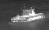
- Closed Circuit Cameras
- Infrared sensors
- Automatic Identification System (AIS)
- Transponders
- Underwater Intruder Detection
- Land-based Mobile Sensors
- Direction Finding Sensors
- Chem/Bio Sensors
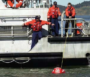
Search and Rescue (SAR)
When disaster strikes at sea, minutes and even seconds often mean the difference between mission success and failure, rescue or loss and life and death.
In coastal and major inland waterways, coast guards and other maritime safety agencies are called upon to dispatch rescue forces, conduct search and rescue missions and to provide initial response to national security and environmental threats.
The SAR systems provide shore-based infrastructure, including emergency communications, command and control and rescue services to save lives and property at risk in the maritime environment.
The TMP-MTM300 system collects and processes distress call information, and becomes a platform for computer-aided search planning and modeling to quickly locate a lost or distressed vessel. The system can be used to facilitate decision-making and management of the rescue phase of the recovery effort.
The system:
- Receives maritime distress and emergency response alerts
- Coordinates SAR personnel and assets including aircraft, rescue boats, fire-fighting and de-watering equipment
 Communicates with mariners
- Provides command and control for operational missions in coastal and inland waterways
- Provides Global Maritime Distress and Safety Systems (GMDSS) compliant communications to monitor both voice and DSC distress calls in Satellite, UHF, VHF-FM, MF and HF marine and aviation bands.
Vessel Traffic Management
Increasing economic activity throughout the world means more ships, more cargo and more traffic in ports, coastal areas and regional waterways. The commercial health of ports and harbors depends on managing traffic efficiently. Throughput can be restricted by bottlenecks at anchorages, quays, berths, rivers and waterways. Pleasure craft, fishing boats and workboats can cause congestion, and many do not have the required communications tools on board. Collisions, oil spills and chemical/HAZMAT cargoes pose threats to commerce, environment and humans. New port development plans include requirements for information systems and safety systems.
Port and harbor authorities must monitor and provide assistance to transiting vessels, calling vessels and departing vessels. Multiple authorities, agents, shippers, harbormasters and pilots all have an interest in the vessel actions. Existing vessel traffic systems are limited in sensor capabilities and lack the capacity to manage this magnitude of information.

Tempestini Group provides Vessel Traffic Systems that include a tightly integrated information backbone allowing full sharing of information about arrivals, departures and transits among all the maritime parties while processing ever-changing elements of the traffic itself. Our TMP-MTM300 system integrates multiple types of sensors, including radar, cameras, radio direction finders, transponders, hydrographic and meteorological. Integration of AIS provides positive identification of approaching vessels and automatically stores this information in the database. TMP-MTM300 facilitates the rapid assimilation of this information and delivery to the navigational decision makers on land and at sea, using geographic display techniques and automated decision processes.
Your system can be configured to provide:
- Automated reports to facilitate coordinating and planning resource (land-side), movement histories and schedules (fairways, anchorages)
- Easy access to and sharing of controlled information
- Easy import and export of graphical information
- User friendly and automated workstation displays
- Support to HAZMAT and incident response teams, maritime police, coast guards, etc., through an integrated communications system
- Web access on a controlled or subscription basis
- Integration with existing databases and systems
- Vessel track and other port information to participating vessels
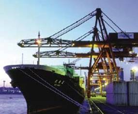
Port Management
Vessel
Safety and efficiency are also critical to port operations. Environmental concerns are particularly important to the operation of oil and gas ports. Port Management systems integrate expert, rule-based software with a variety of sensors to meet these needs. Electronic charts are embedded to maximize navigational safety for approaching and departing vessels. Electronic Data Interchange (EDI) is employed to provide comprehensive intra-port information sharing. Carry-on Navigation and Display Systems provide pilots with a full range of capabilities including complete navigation and docking assistance and onboard VTS with expert system functionality.
Pre-planned ship mooring arrangements, approach-speed monitors and mooring strain sensors facilitate vessel arrival and ensure safe mooring operations to eliminate damage to facilities.
In the case of an accident, our Port Management Systems can improve emergency response to oil spills or hazardous conditions and provide communications links to emergency/environmental agencies to facilitate spill containment and deployment of clean-up equipment.
Our hydrographic and meteorological sensor suite provides real-time tide, current, salinity and weather information. Integrated radar and camera systems provide vessel location and visuals. Vessel clearance systems that detect bridge air gap and under keel clearance assure safe passage through channels and under bridges. Laser Docking Systems assist safe oil tanker docking.
Turnkey Solutions, Maximum Value
Tempestini Group offers total turnkey solutions, fully integrated and tailored to your unique operational needs. The powerful features of our maritime software can be easily tailored for any maritime mission, whether you need a stand-alone solution for a specific area or an integrated system across a wide-area network for a broader mission.
We perform a thorough system definition, requirements analysis and design certification. Tempestini Group systems engineers carefully analyze the maritime situation and select the best technology to meet your specific needs. Commercial computing and communications systems, networks, sensors and modern workstations provide the latest vessel detection and tracking tools available.
Each system is designed with open systems architecture to allow interoperability with existing components and to facilitate expansions and future upgrades as requirements change. We perform site surveys including site selection, evaluation and preparation.
Our prime contract responsibility is backed by a Tempestini Group global presence, as we oversee selection and management of subcontractors and vendors, including identification of in-country teammates and suppliers to ensure after-sales service and technology transfer.
Tempestini Group performs full integration and testing of all system components. We provide complete logistics and product support services worldwide, including systems installation, site and system acceptance testing and commissioning. To ensure effective operation of your system, we can develop and deliver training programs, maintenance programs, warranty support services, including 24-hour remote access, post-warranty plans, and system and software upgrades and expansions. If desired, we can even provide total system operations services. Tempestini Group product procurement services include financing, leasing and concessions. If desired, we can work with you to identify financing sources, including government, private and multi-national institutions.
Maritime Command and Control System Features
Open Architecture |
|
Fused Data Display |
|
Integrated Database |
|
Database Linked to Workstation Displays |
|
Sensor Data Sharing |
|
